The Kent Hill Gravel Mine and Quarry in Audley, Staffordshire, remained undocumented in early mapping records, including Yate's 1775 map, Teesdale's 1832 map, and the first Ordnance Survey map from 1840, suggesting no industrial activity at the site during these times. It was not until the 1889 Ordnance Survey map that evidence of industrial changes appeared, showing a small slope and a magazine associated with Riley's, a local gunsmith, rather than quarrying activities.
Watch my video exploring the mine on YouTube
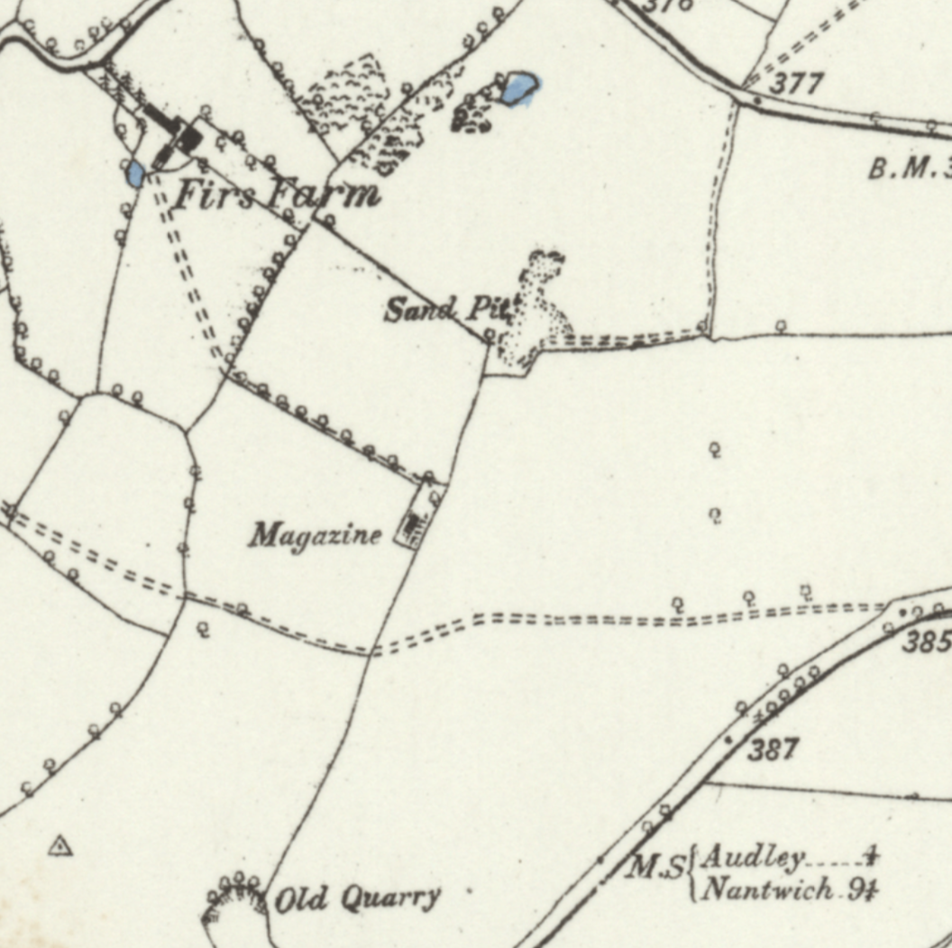
The term "magazine" on these maps indicated buildings associated with gunpowder storage, reflecting the importance of gunpowder for both military and industrial uses in the 19th century. These buildings were strategically located away from populated areas for safety reasons.
By the turn of the 20th century, Ordnance Survey maps from the early 1900s depicted an expanded hachure slope, hinting at the beginnings of a small-scale sand or gravel operation by a local farmer or landowner. Quarrying began in earnest in 1929 when Charley Edwards, noticing an abundance of pebbles in his field, started extracting gravel without official permission. This initial lack of documentation likely explains the scarcity of written records about the quarry.
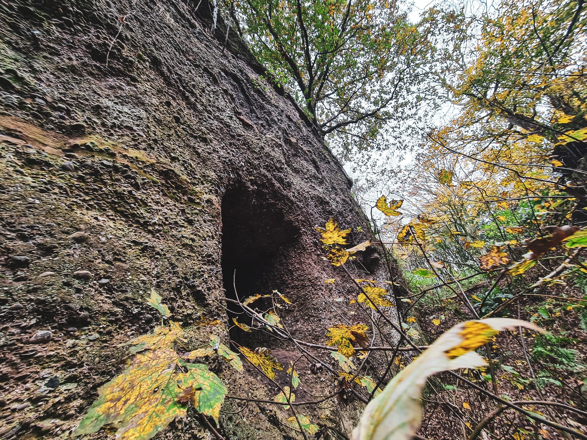
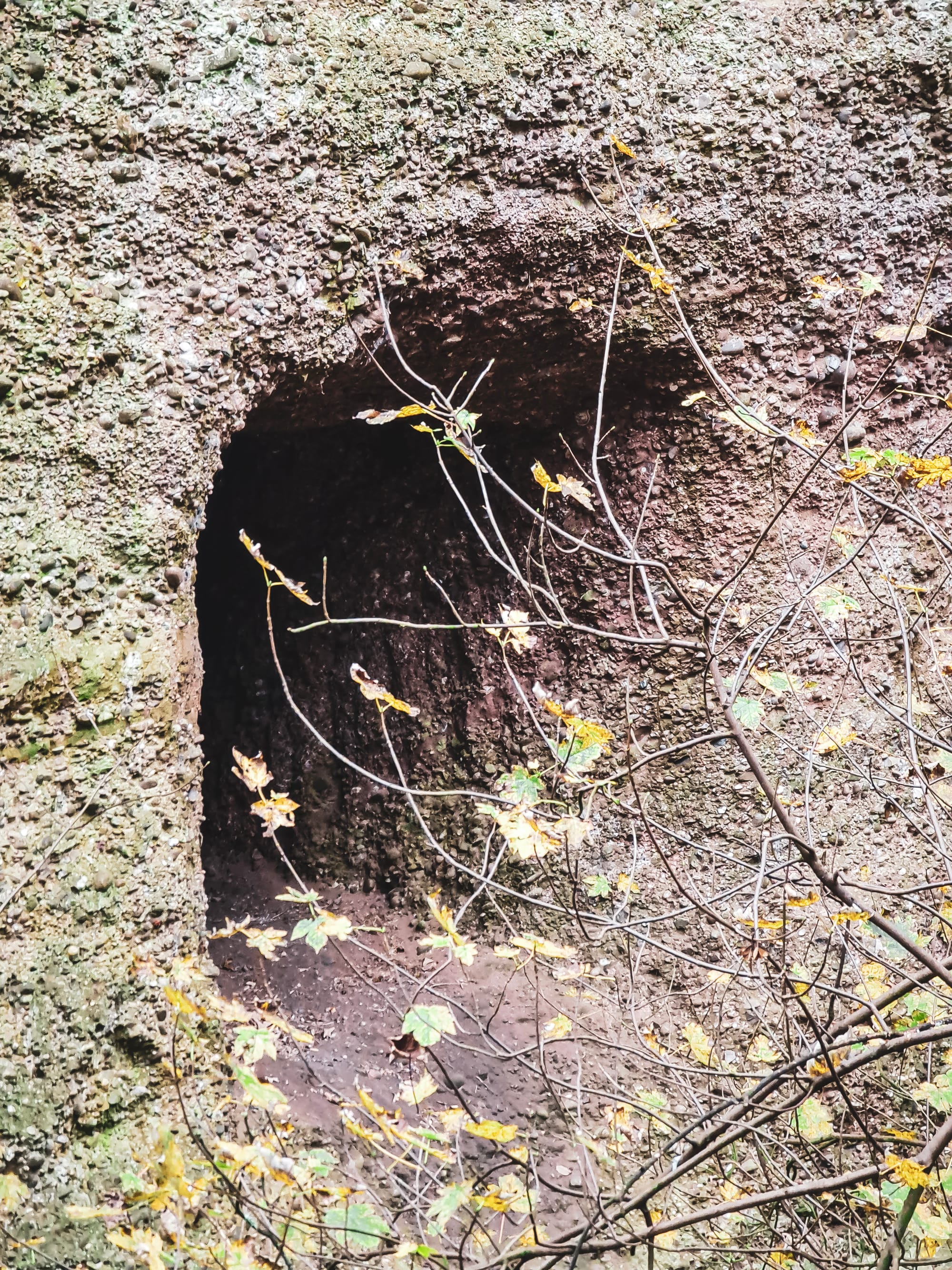
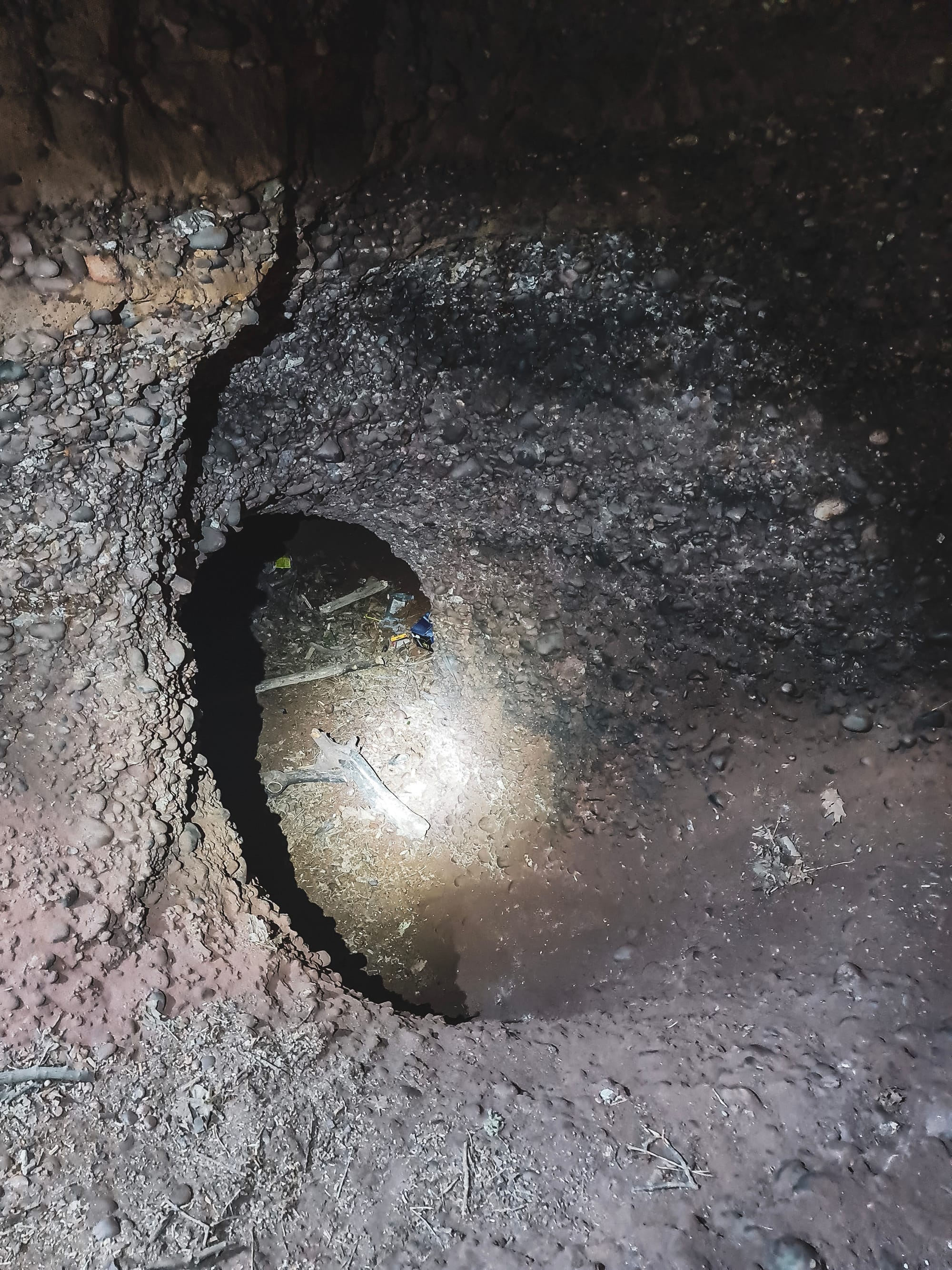
The operation initially involved open-cast extraction, moving underground as output increased. The first documentation of both surface and subterranean workings appeared on the 1946 Ordnance Survey sheet. Techniques evolved from hand drilling and blasting with powder to more modern methods, including compressed air drilling. The extraction process, however, led to health issues among workers, notably silicosis from inhaling silica dust.
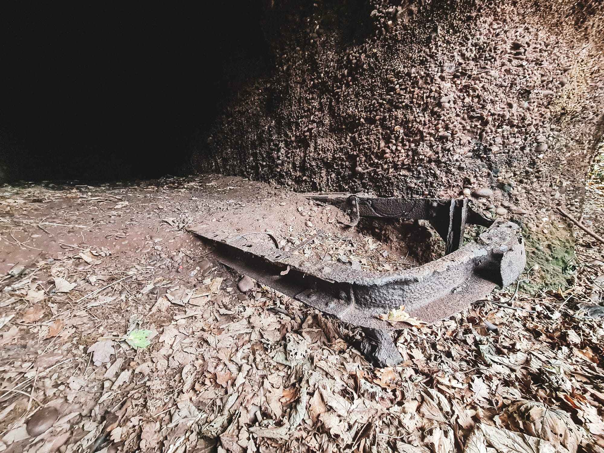
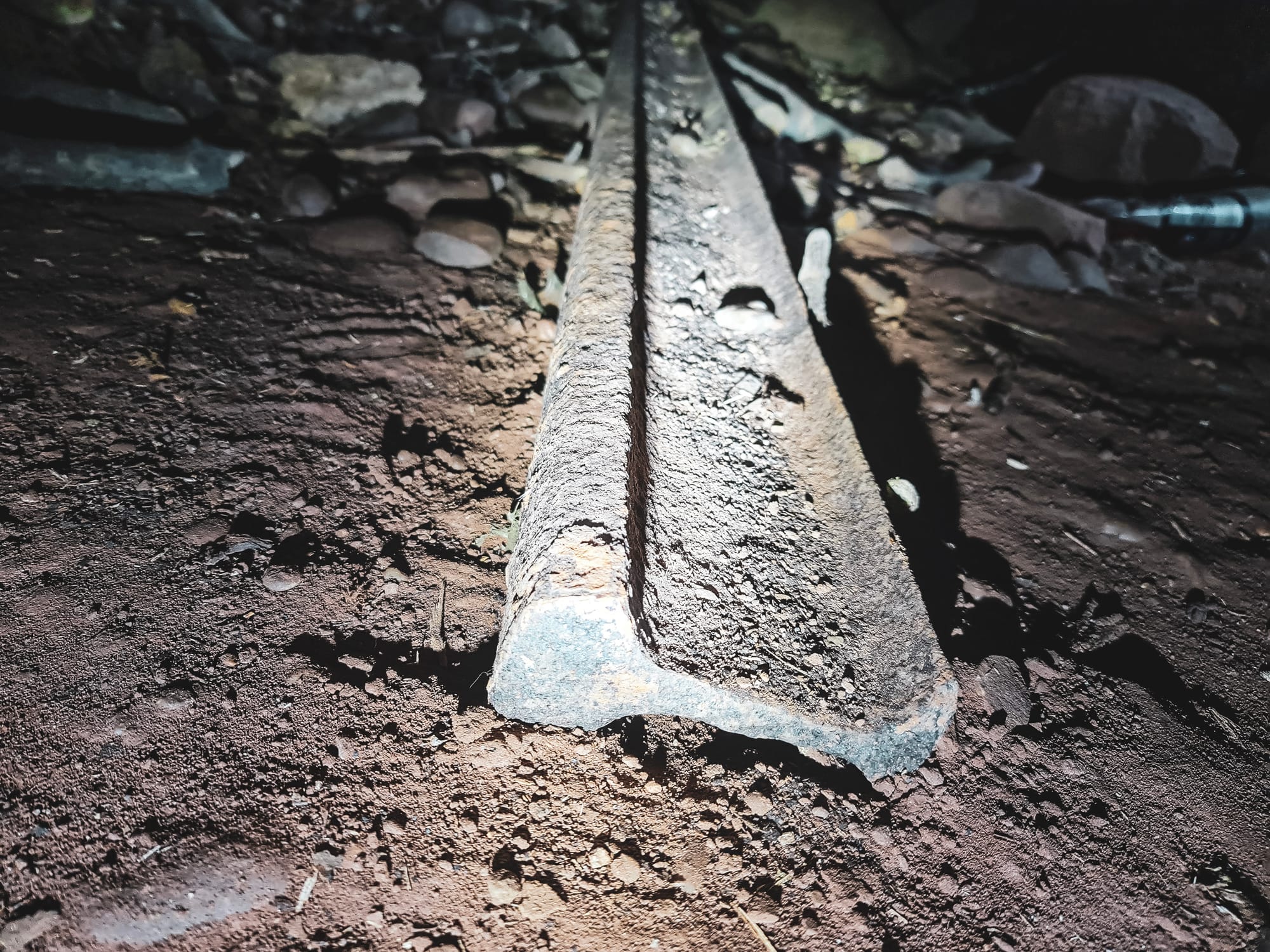
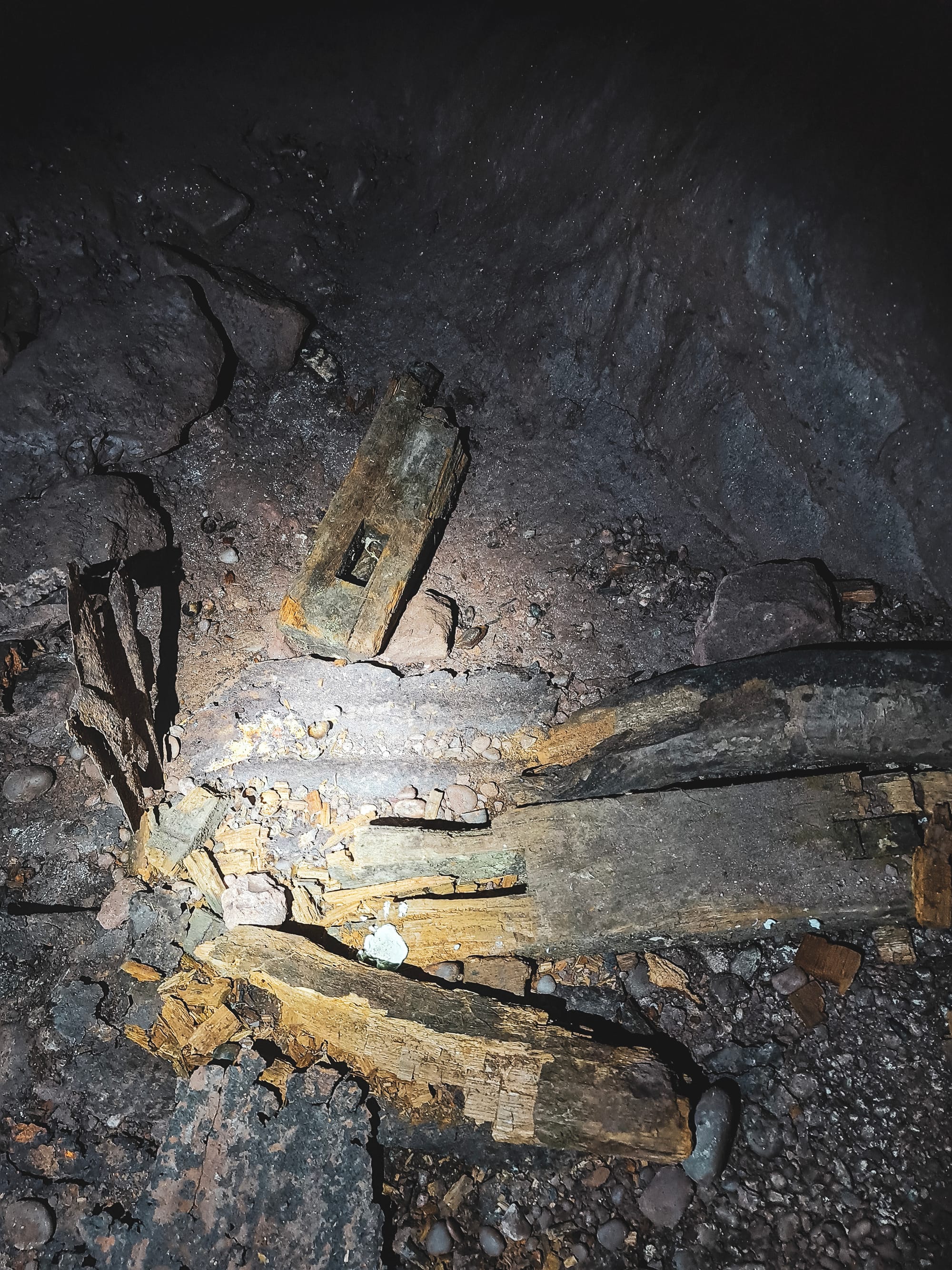
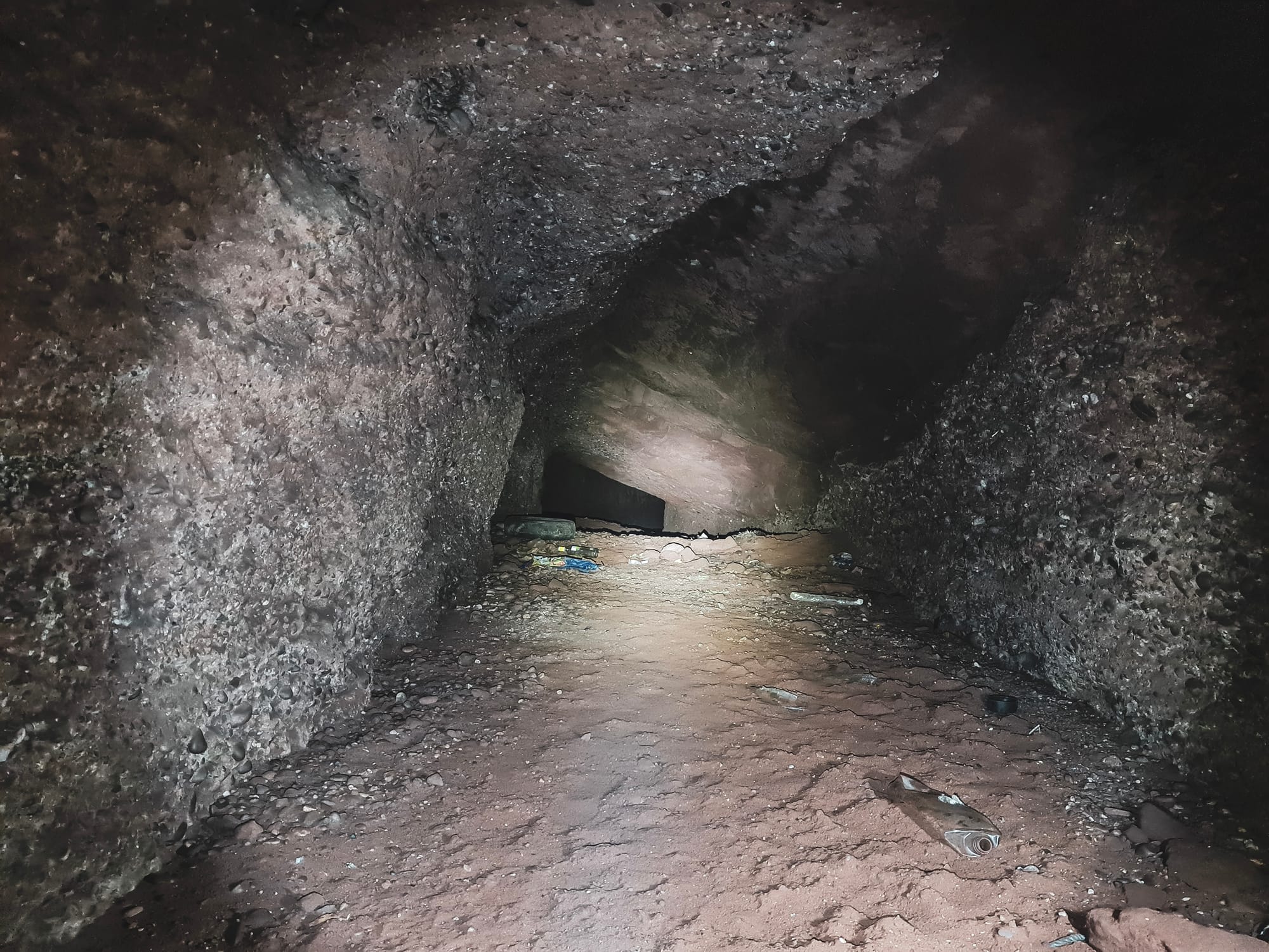
The remnants of a small mine wagon and a rail
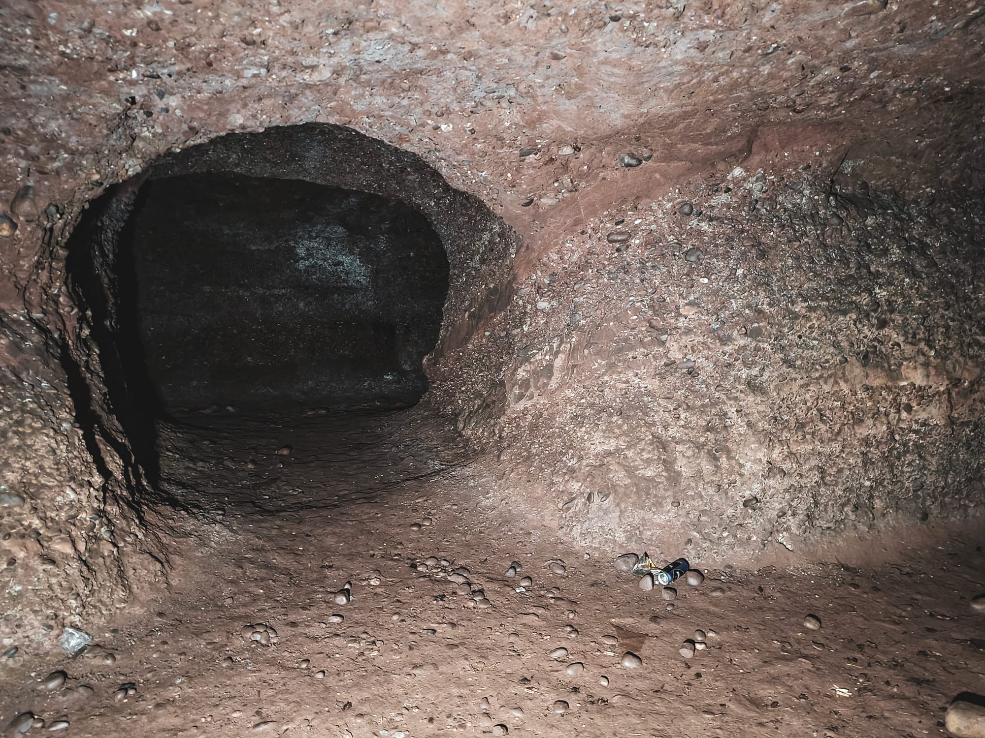
Gravel transportation within the mine utilized wagons on rails, facilitated by the mine's inclined passages. After extraction, the gravel was processed on-site and sold primarily to the Water Board for infrastructure projects. Ownership of the quarry eventually passed from Edwards to Mr Farrington and then to Mr Ellerton, with Edwards retaining a royalty. Quarry operations ceased at the end of WWII, and the site was sold to the Potteries Water Board around 1950, with significant clearing and infilling operations following.
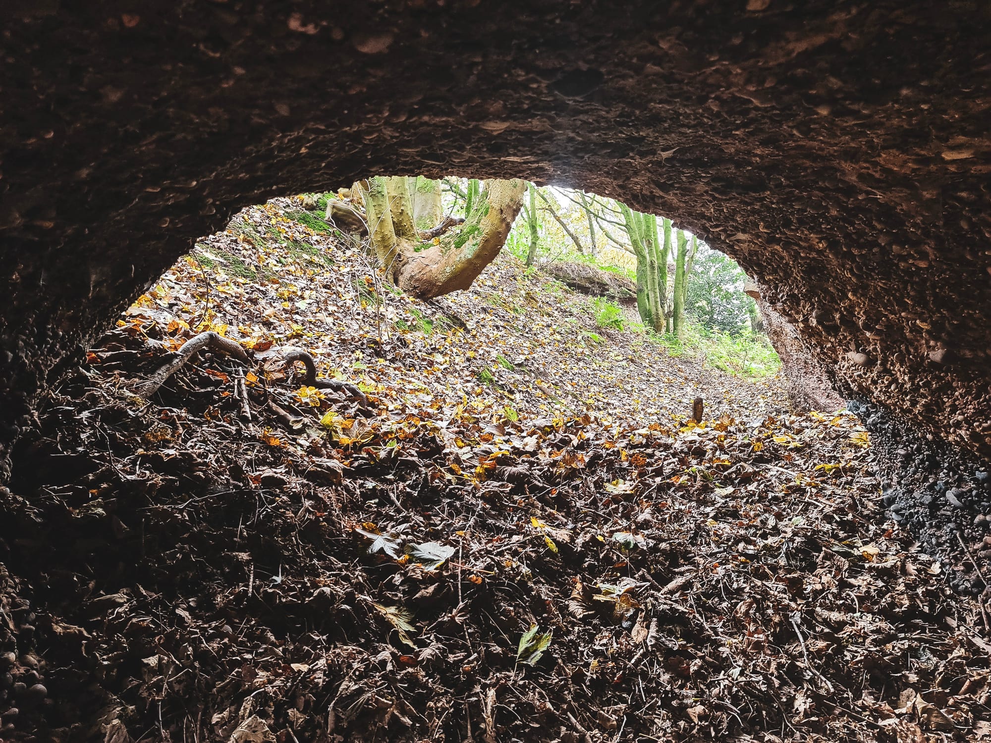
By the 1980s, the site's old tunnels had been repurposed for emergency water overflow, a change that necessitated enhanced security measures to mitigate the risk of accidental flooding.
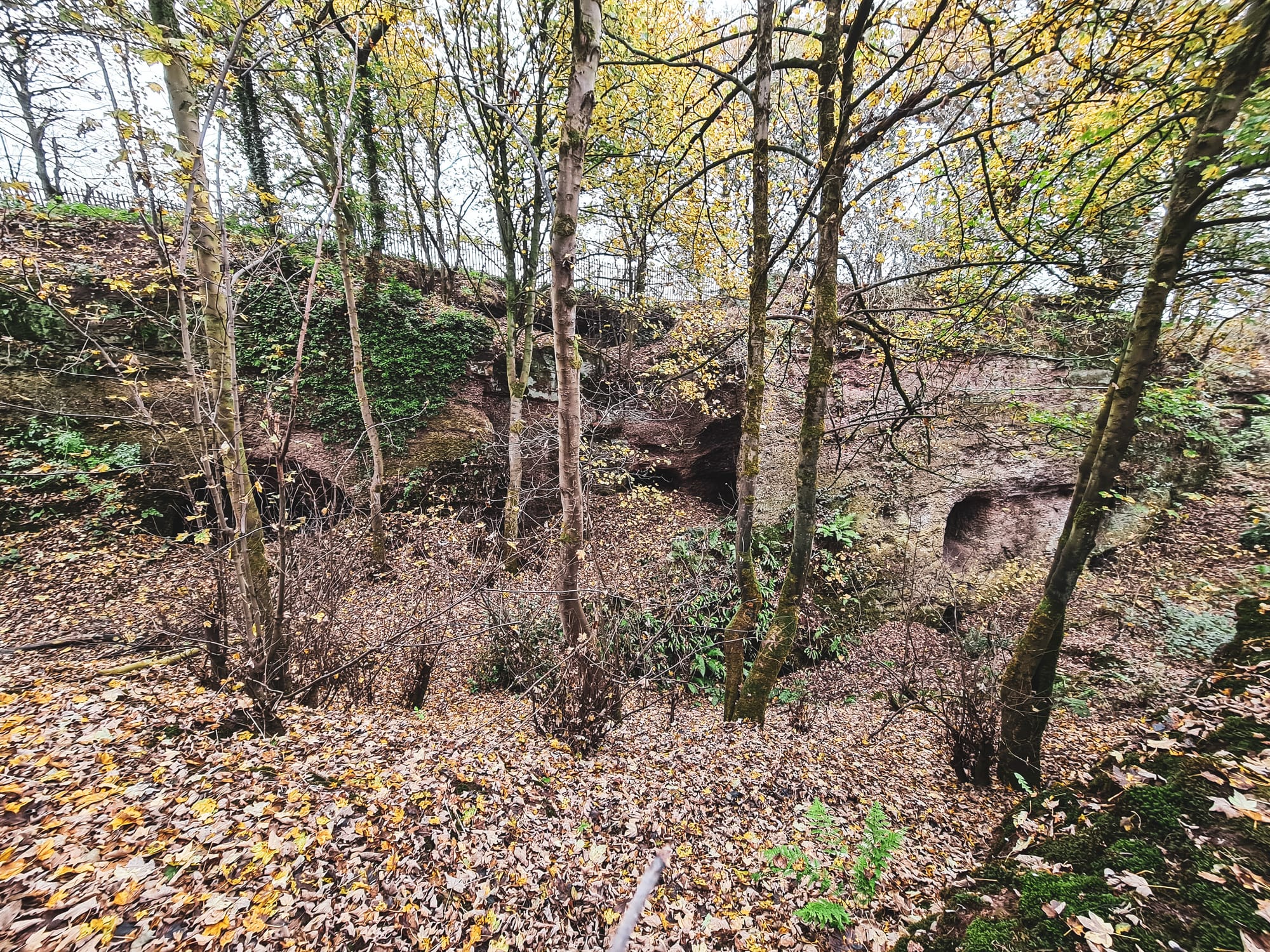
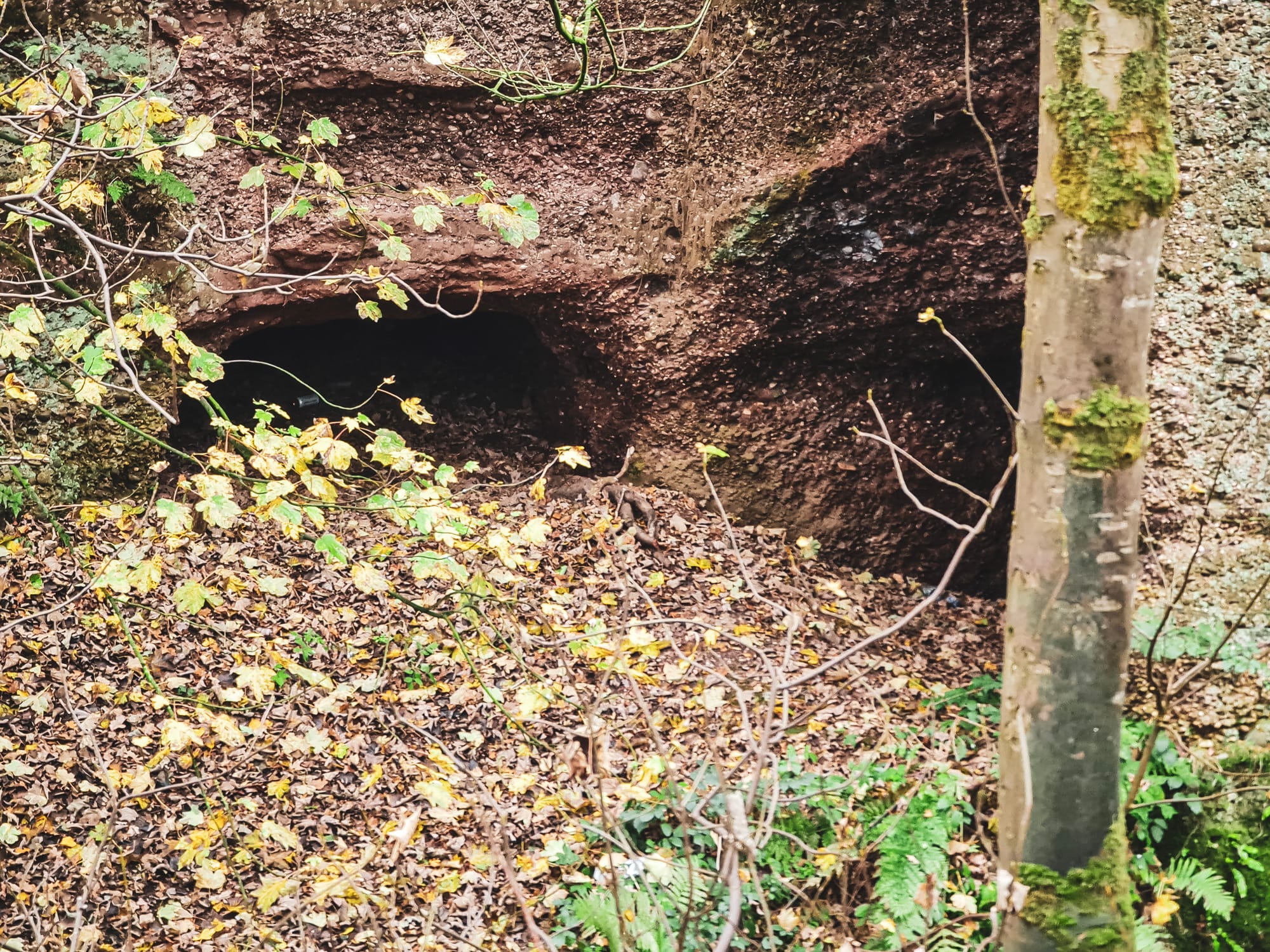
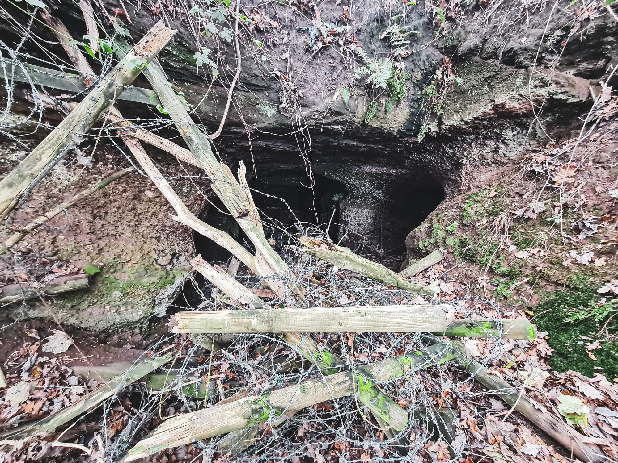
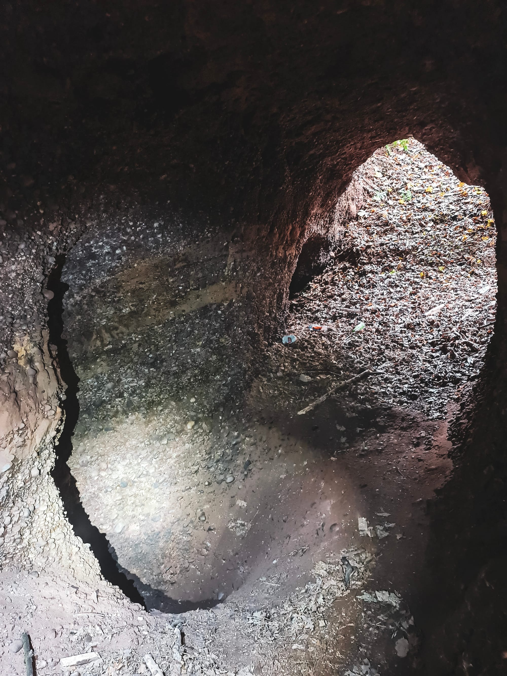
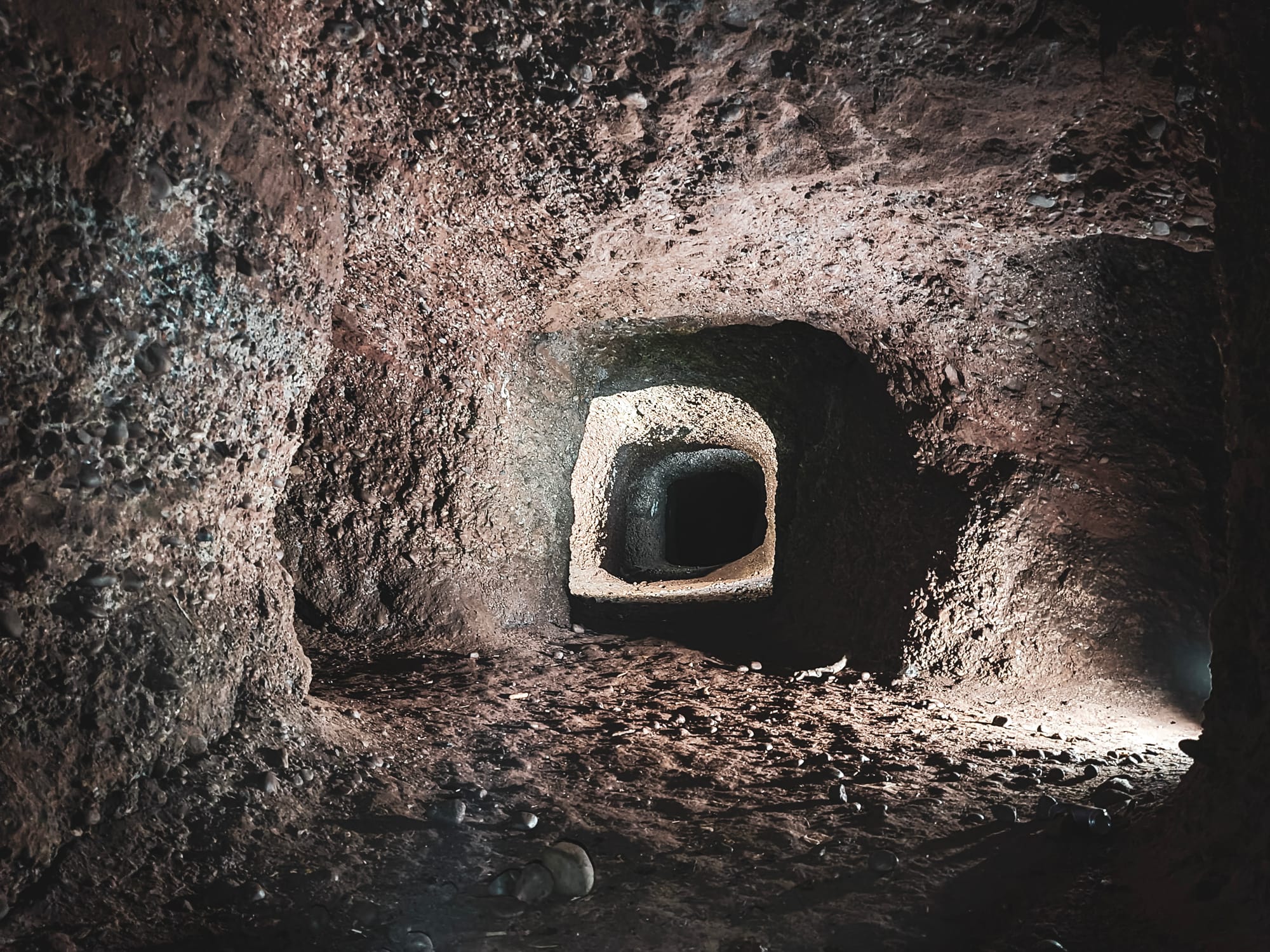

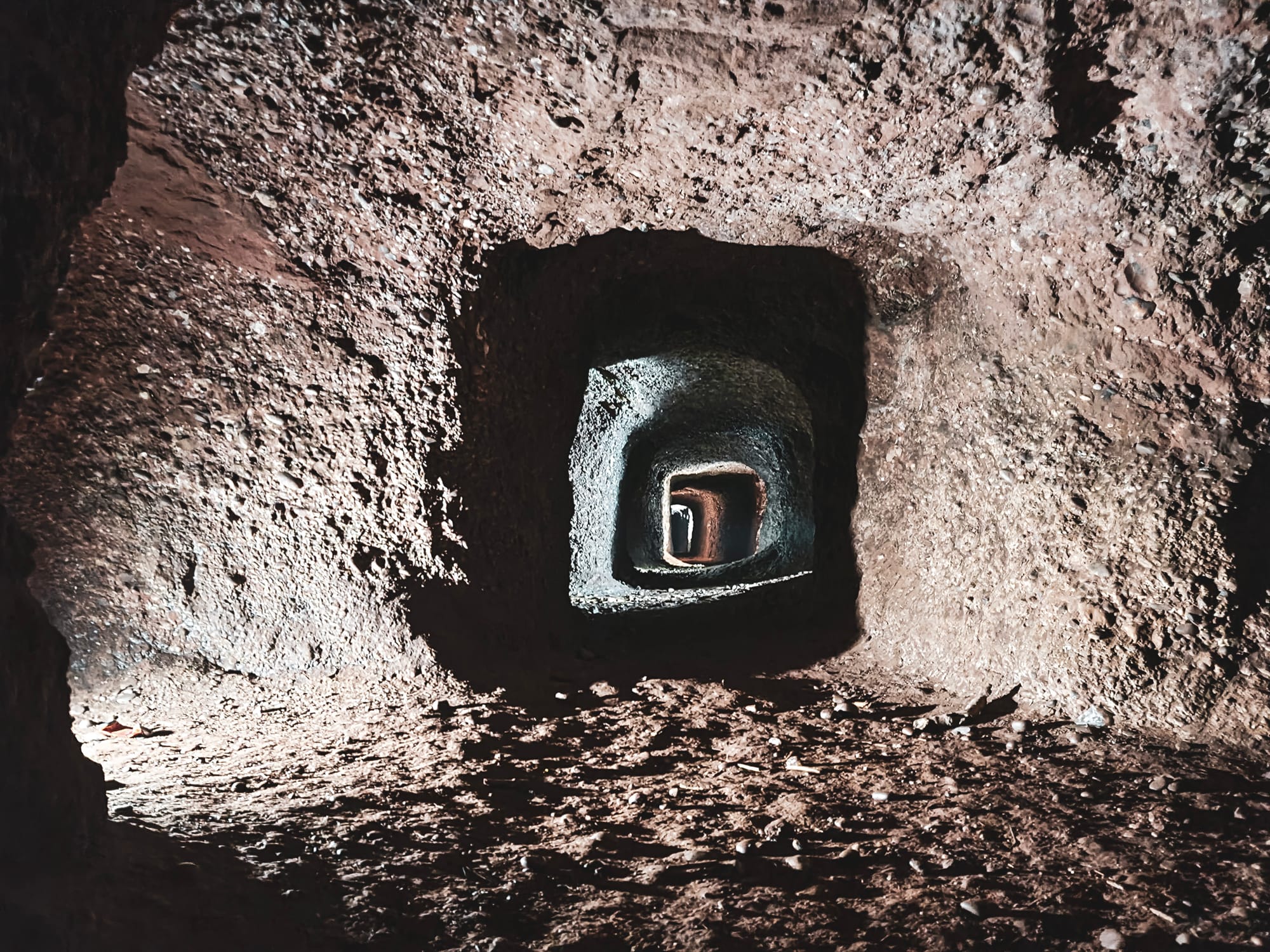
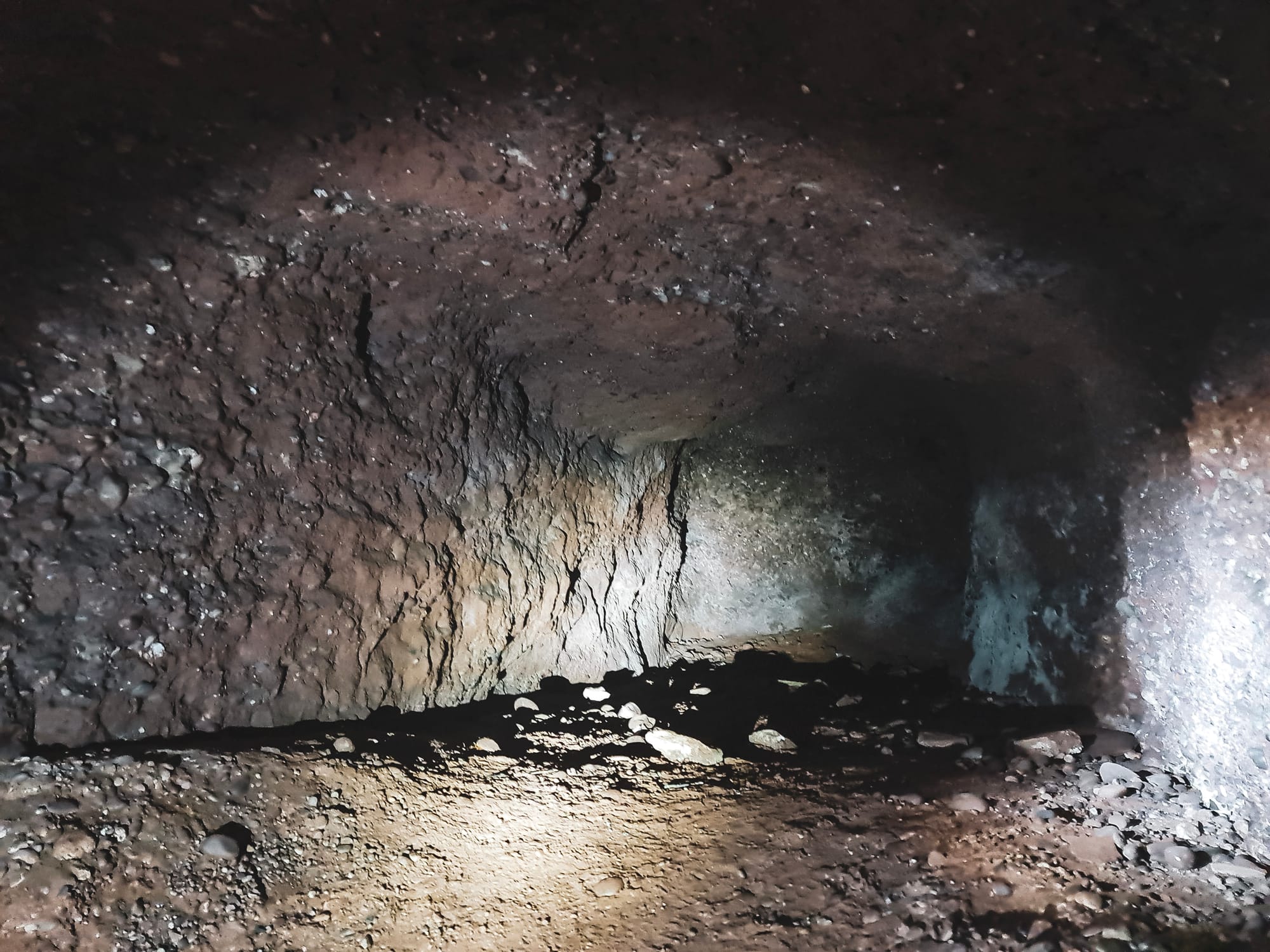
The quarry's layout spans approximately 3250 square meters, divided into Upper, Middle, and Lower Levels, each with unique features and functions. The Upper Level, likely older exploratory workings, and the Middle Level, marked by its proximity to the Cooper's Green Reservoir overflow pipe, illustrate the site's complexity. The Lower Series, characterized by its intricate network and evidence of past operations, highlights the adaptability and ingenuity of its workers.
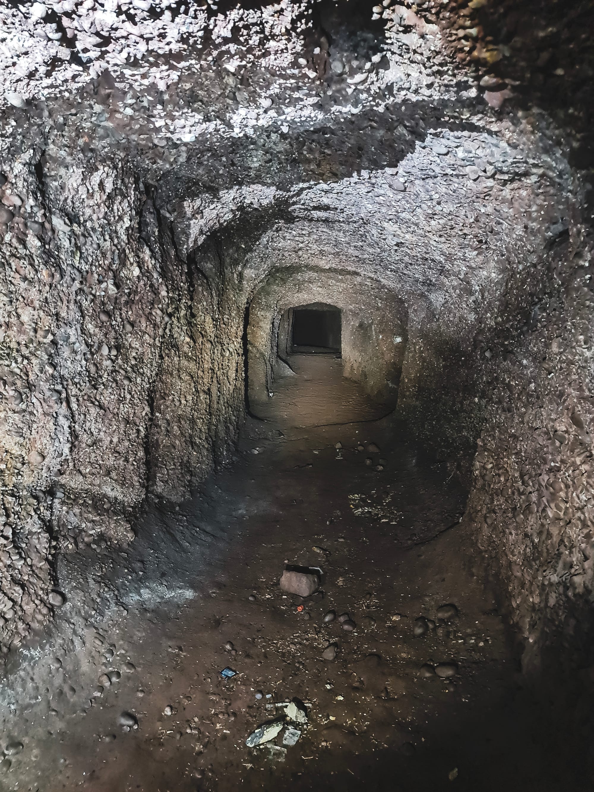
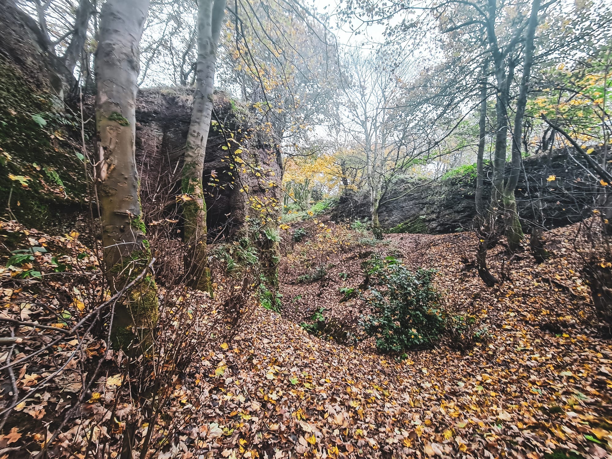
The Kent Hill Gravel Mine showcases the Chester Pebble Beds from the Triassic period, highlighting the area's ancient river systems. These rock layers, part of the Sherwood Sandstone Group, offer insights into the environmental conditions of that era. The site is significant because it reveals over 12 meters of these pebble beds beneath a sandstone layer, with cliffs up to 14 meters high. It's an important geological site because it helps us understand how landscapes were shaped millions of years ago and the natural history between the Cheshire and Staffordshire Basins.
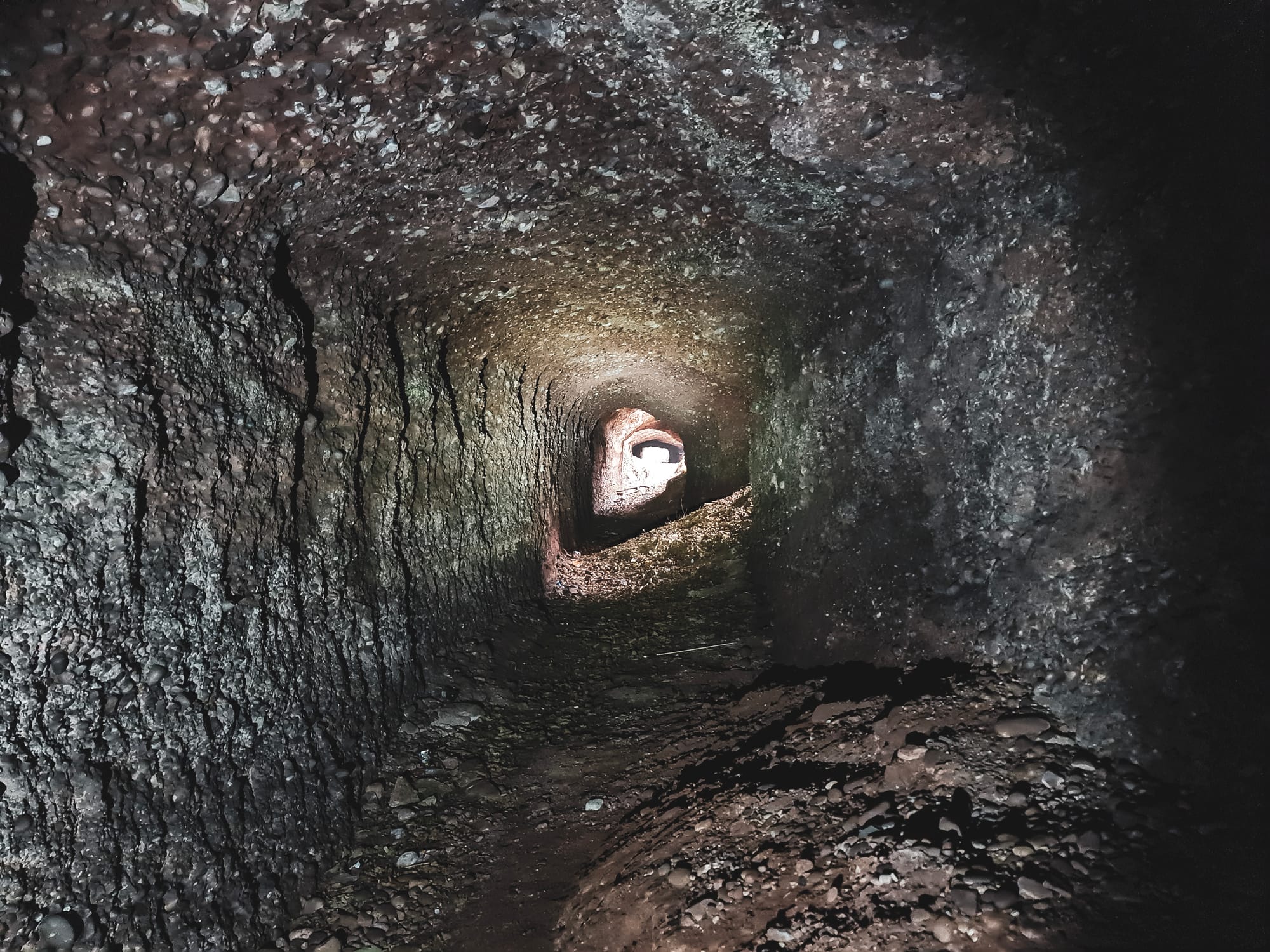
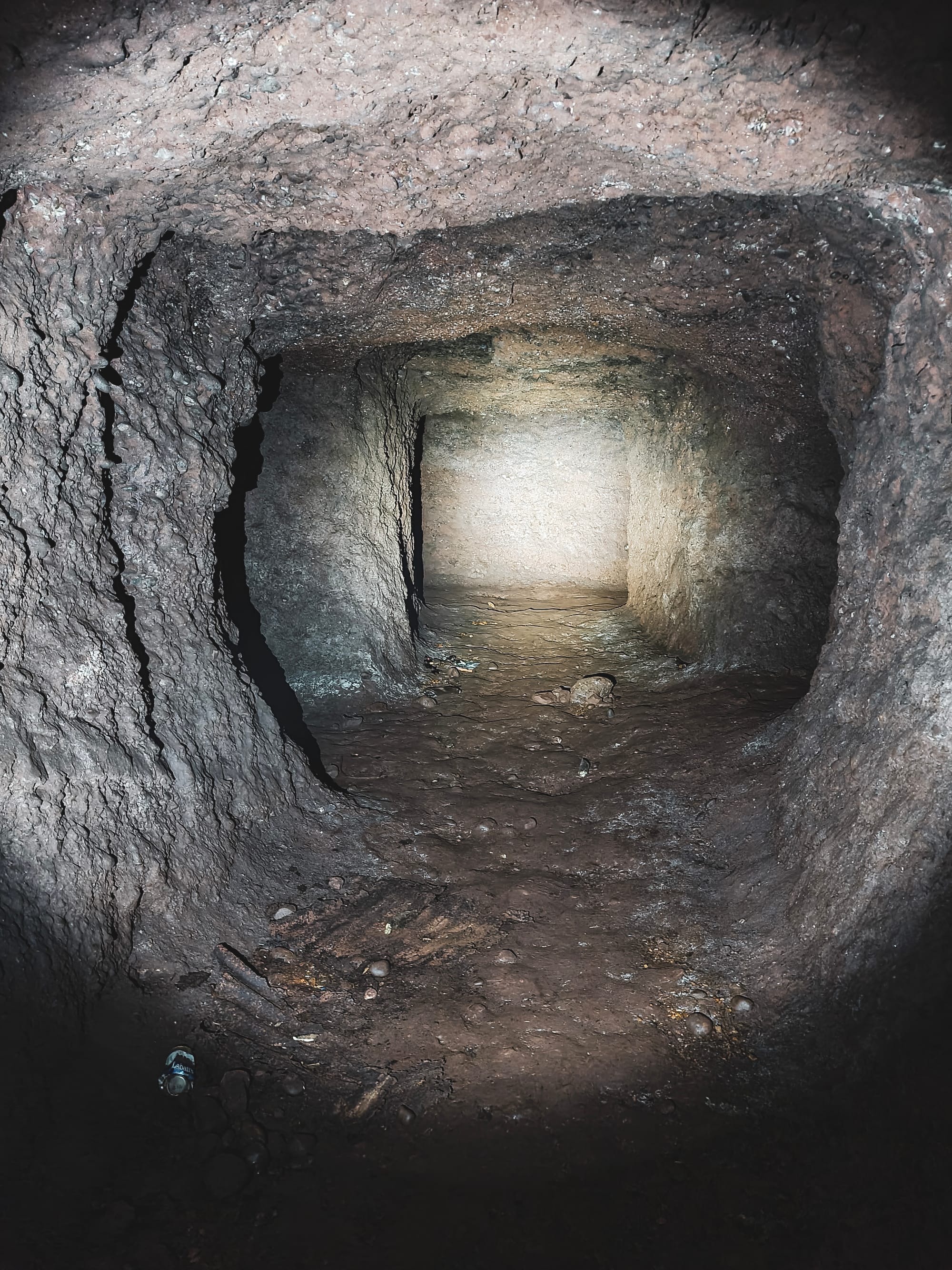

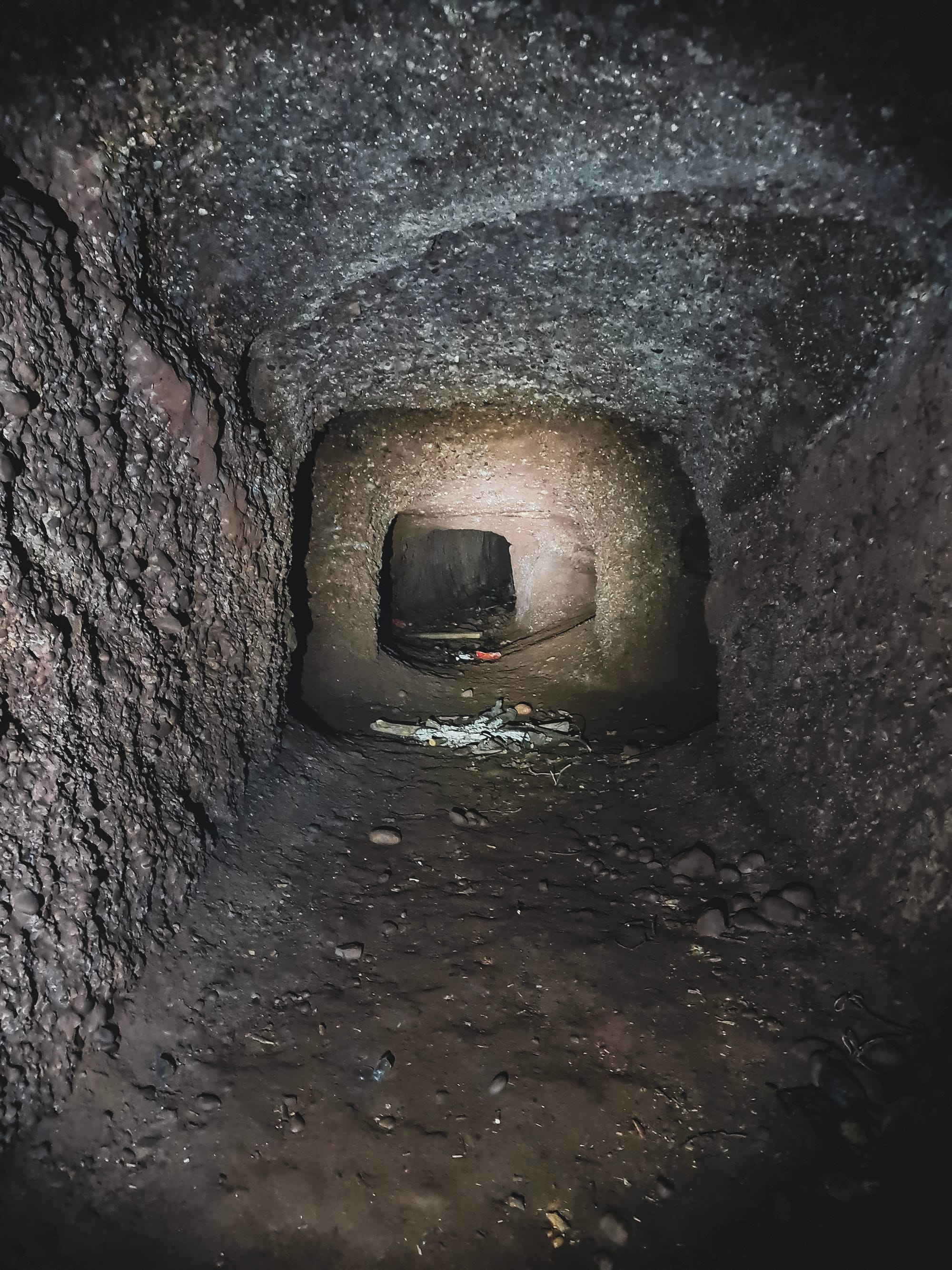
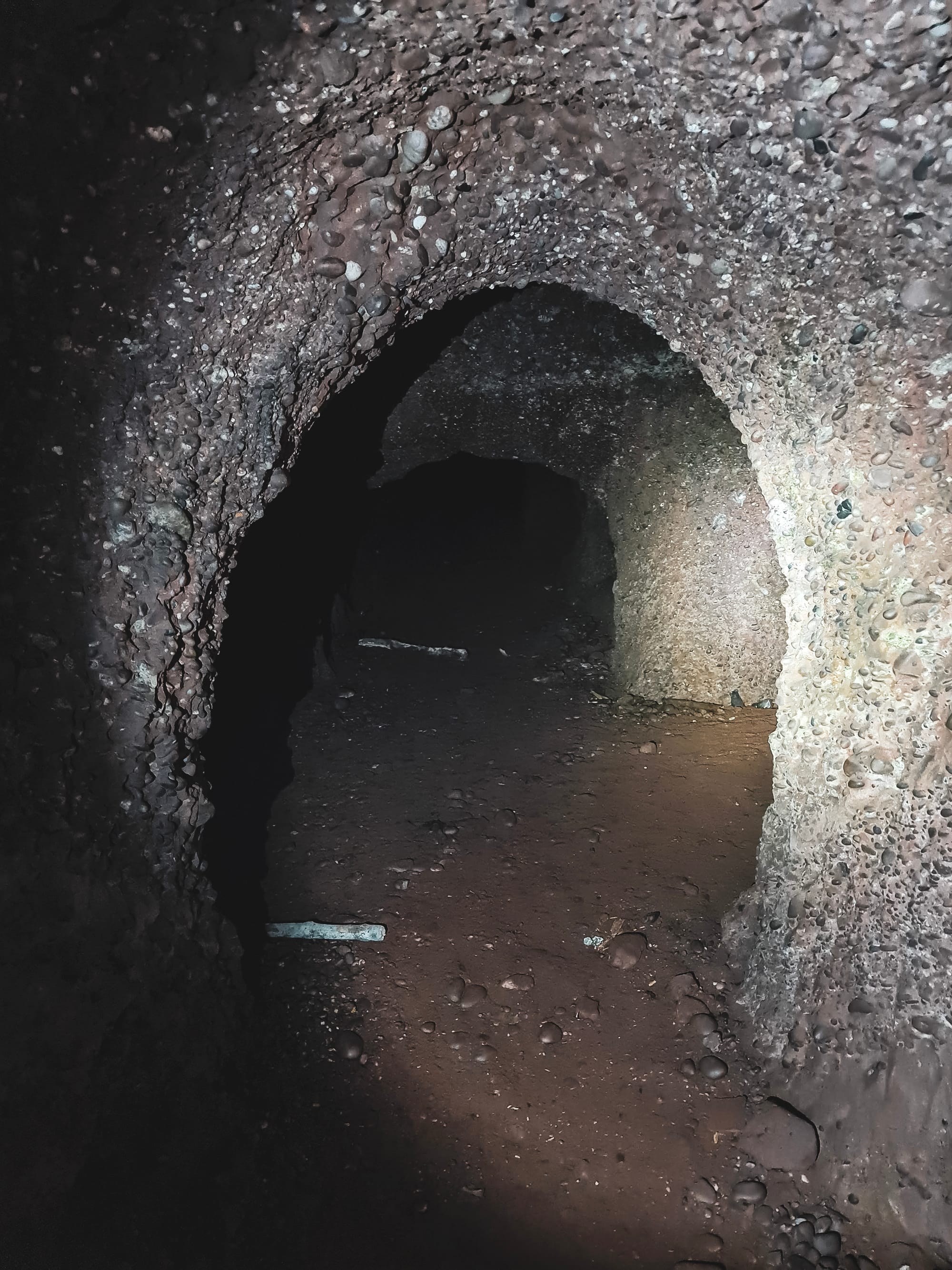
At the Kent Hill Gravel Mine and Quarry, an unusual mining technique called "pillar and stall" was used for extracting gravel, making this site quite special in the field of sand and gravel mining. Normally, this method is seen in coal mining, where it helps keep the mine's roof stable while miners remove coal around solid pillars left in place for support.
In the case of Kent Hill, this approach was adapted for gravel, leaving behind pillars of the original rock formations—specifically, the conglomerate and pebble beds of the Triassic Chester Pebble Beds within the Sherwood Sandstone Group. These pillars supported the roof and allowed for safe gravel extraction around them.
This use of pillar and stall mining for gravel is not just a technical interest; it reflects the quarry's unique place in mining history and its contribution to understanding geological processes. The pillars provide a way to see and study the quarry's geological layers in three dimensions, offering insights into how the area's landscape formed millions of years ago.
Moreover, choosing this method helped protect the site. It meant gravel could be taken out in a way that was less damaging to the environment than more aggressive mining methods could be. This careful approach to mining at Kent Hill shows how extraction and preservation can work together, preserving the site's geological and historical value.
The mine also helps scientists understand how rivers flowed millions of years ago because the rocks show that water used to move toward the north. This matches with what we know from other places in Staffordshire. Plus, since there aren't any big cracks or minerals that shouldn't be there, researchers can study the rocks just as they were laid down a long time ago.
Back in the 1980s, they decided not to fill in the quarry with other materials. This was because they realized how important it is for understanding Earth's history. Now, people can still visit for research projects, helping everyone know more about the Triassic period world. The Kent Hill Quarry is special because it combines natural history, the history of mining, and efforts to keep important places safe for the future.
Today, the Kent Hill Gravel Mine and Quarry stands as a unique example of industrial heritage and geological interest in the UK.
Thank you for reading!
If you like what you have read, please feel free to support me by following and signing up for my newsletter and/or buying me a coffee!

If you love our local history, don't forget to follow me, check out more of my videos and my website http://www.theredhairedstokie.co.uk
You can now also join my Patreon - www.patreon.com/TheRedHairedStokie
Check out my recommended reading list